Science
New Interactive Map Reveals Wairarapa Valley’s Geological Secrets
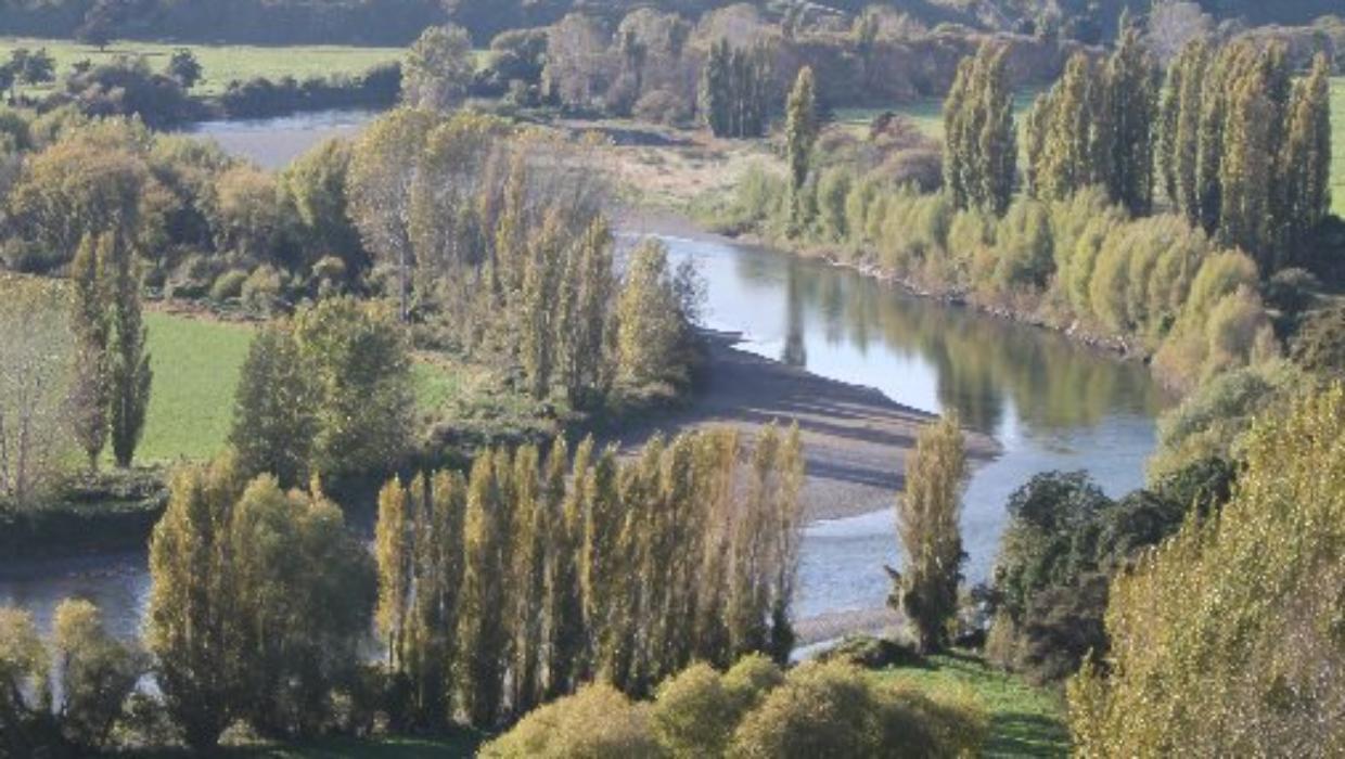
An innovative interactive map showcasing the geology of the Ruamāhanga region in the Wairarapa Valley has been launched, allowing users to explore the underlying geological structures in unprecedented detail. This project utilizes data collected from advanced helicopter-mounted scanners, which have provided high-resolution imagery and insights into the valley’s geological makeup.
The mapping initiative, spearheaded by GNS Science, aims to enhance understanding of the area’s geological features, which include sediment layers and fault lines. The helicopter-mounted scanners have been instrumental in gathering extensive data over the region, significantly improving the quality and accessibility of geological information.
Advanced Technology in Geology
The technology behind the mapping involves the use of Light Detection and Ranging (LiDAR), which emits laser pulses to measure distances and create detailed 3D models of the terrain. This method allows for the identification of various geological formations and provides vital information for both researchers and the local community.
According to GNS Science, the interactive map is not only a valuable resource for educational purposes but also plays a crucial role in natural hazard assessment. Understanding the geological context of the Wairarapa Valley can help in predicting potential landslides or earthquakes, contributing to improved safety measures for residents.
The map features user-friendly navigation, enabling individuals to zoom in on specific areas and explore geological characteristics at various depths. This level of access to detailed geological data is particularly significant for educational institutions, local governments, and environmental agencies.
Community Engagement and Future Prospects
Community engagement is a core aspect of this initiative. Local schools and universities have already expressed interest in incorporating the interactive map into their curricula. The ability to visualize and understand geological processes fosters a greater appreciation for the natural environment among students.
Furthermore, the project has sparked interest in potential future applications, including land-use planning and environmental conservation efforts within the Wairarapa Valley. By leveraging this advanced geological data, stakeholders can make informed decisions that align with sustainable development goals.
As the interactive map of the Ruamāhanga geology continues to evolve, it serves as a testament to the power of technology in enhancing our understanding of the natural world. This initiative not only showcases the rich geological history of the Wairarapa Valley but also paves the way for future research and community involvement.

Crash on Auckland Harbour Bridge Closes Lanes, Causes Delays

JD Trask and Justin Lester Tackle Key Issues in Weekly Wrap-Up

JD Trask and Justin Lester Discuss Key Issues Facing Wellington

Aimee Lou Wood Reacts as Sydney Sweeney Defends Controversial Ad

New Zealand’s Obesity Challenge: Should Weight Loss Drugs Be Funded?

Gough Commits $100K Donation to Mayor’s Welfare Fund This Year

Howick RSA Commemorates Armistice Day with Special Ceremony

New Zealand Police Mandate Breath Test Training after Falsification Scandal

Ben Stokes Trains with Sydenham Cricket Club Before Departure

Test Your Knowledge: Take the Herald’s Afternoon Quiz Today

PM Faces Backlash from Fans During Netball Trophy Ceremony

Dunedin Designers Win Top Award at Hokonui Fashion Event

Liam Lawson Launches New Era for Racing Bulls with Strong Start

Disney Fan Reveals Dress Code Tips for Park Visitors

Walking Faster Offers Major Health Benefits for Older Adults

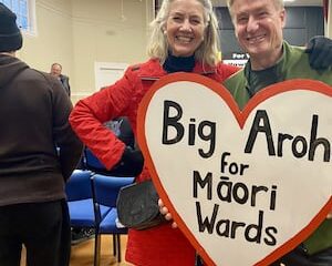
Coalition Forms to Preserve Māori Wards in Hawke’s Bay

Scots Rally with Humor and Music to Protest Trump’s Visit

UK and India Finalize Trade Deal to Boost Economic Ties
-
 World3 months ago
Test Your Knowledge: Take the Herald’s Afternoon Quiz Today
-
 Sports3 months ago
PM Faces Backlash from Fans During Netball Trophy Ceremony
-
 Lifestyle3 months ago
Dunedin Designers Win Top Award at Hokonui Fashion Event
-
 Sports3 months ago
Liam Lawson Launches New Era for Racing Bulls with Strong Start
-
 Lifestyle3 months ago
Disney Fan Reveals Dress Code Tips for Park Visitors
-
 Health3 months ago
Walking Faster Offers Major Health Benefits for Older Adults
-
 World4 months ago
Coalition Forms to Preserve Māori Wards in Hawke’s Bay
-
 Politics3 months ago
Scots Rally with Humor and Music to Protest Trump’s Visit
-
 Top Stories4 months ago
UK and India Finalize Trade Deal to Boost Economic Ties
-

 Entertainment3 months ago
Experience the Excitement of ‘Chief of War’ in Oʻahu
-
 World4 months ago
Huntly Begins Water Pipe Flushing to Resolve Brown Water Issue
-

 World4 months ago
Fonterra’s Miles Hurrell Discusses Butter Prices with Minister Willis